Daily Weather with Surf, Wind and Tropical Storm Forecasts

Daily Baja Weather Forecast
Sunday 21 June 2026 6:15AM PDT
Current Weather Conditions
The atmospheric conditions across the Northeast Pacific are heavily impacted by a compressing marine boundary layer interacting with intense continental thermal low pressure. High pressure situated well offshore continues to feed a cool maritime air mass toward the coast, but an unseasonably strong thermal engine over the interior desert basins is creating rapid cross-peninsular pressure gradients. This weekend, that offshore ridge is subtly relaxing its grip, allowing the local diurnal sea breezes to have a much bigger say in the weather.
This accelerated clearing will open the door to faster solar radiation in those areas, causing surface temperatures to rise quicker across coastal zones while pushing interior valleys into an exceptionally warm to potentially hot bracket. A strong south-to-southwest swell train continues to stream into the southern coastlines, while northwesterly winds dominate the outer Pacific shelf. This offshore flow is directly interacting with localized, erratic wind surges and intense, short-lived convective cells sliding off the western side of the Gulf of California. There are absolutely no active tropical cyclones or threats in the basin today, keeping nearshore operations fully favorable.
———————–
National Hurricane Center (NHC) Morning Update
Current Tropical Status
In their morning briefings, the National Hurricane Center confirms that the Eastern North Pacific basin remains quiet with no active tropical storms, hurricanes, or depressions currently in operation. No active tropical cyclones are threatening the region. The broader regional monsoon trough remains quiet across the far southern reaches.
Tropical Weather Outlook
Tropical cyclone formation is not expected across the Eastern North Pacific basin during the next seven days. In the Atlantic basin, the National Hurricane Center is currently tracking a broad area of low pressure that has moved over eastern Mexico and the northwestern Gulf of Mexico. This system is producing disorganized shower and thunderstorm activity. Forecasters note that while environmental conditions could support some slow development of this system over the next several days, its development chances currently remain low at twenty percent over the next seven days. Regardless of any future cyclonic organization, the deep tropical moisture associated with this system poses no threat to the peninsular landmass.
———————–
Regional Forecast for Today
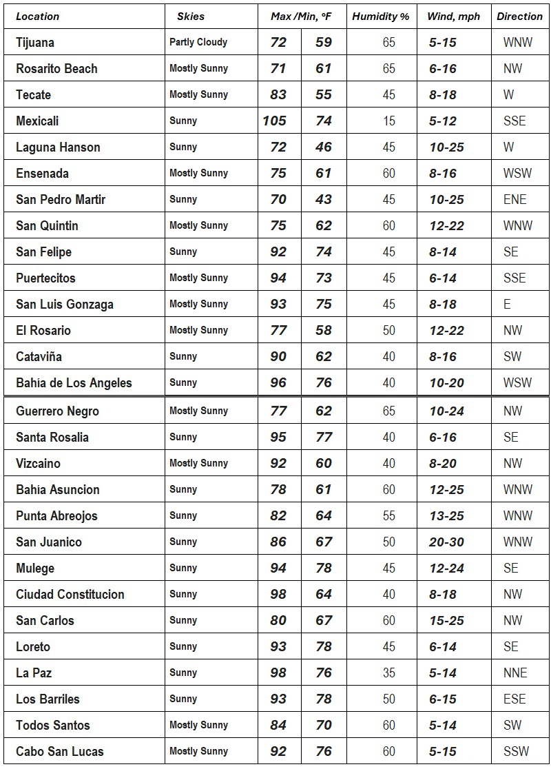
Baja California
Northern sections of the peninsula are experiencing dramatic microclimate variations today following the rapid morning burn-off of the coastal stratus. Along the Northern Baja Pacific coastline, communities from Tijuana and Rosarito Beach down through Ensenada and San Quintín are breaking out into mostly sunny skies ahead of schedule. This fast solar clearance is allowing the daytime to turn quite warm and comfortable, though the immediate air right at the beach fringe remains thick with marine humidity. Winds across these western beaches are pulsing out of the northwest to west-northwest at fresh speeds in San Quintín, and light to moderate clips from Ensenada northward, keeping coastal sea states slightly agitated due to a lingering southwest swell. No additional rainfall is expected along the Pacific coast today.
In contrast, the inland valleys around Tecate are turning a lot hotter under mostly sunny skies with light to moderate afternoon winds. Farther east across the mountains, the Mexicali Valley is entering an exceptionally hot phase, turning a lot hotter to blistering as maximum solar heating takes full effect on the desert floor, pushing light winds from the south-southeast. Along the upper Gulf of California, towns like San Felipe, Puertecitos, and Bahía San Luis Gonzaga are experiencing a much warmer to very hot afternoon under absolute sunshine. Light to moderate wind tracks are maintaining a light surface chop across the shallow water channels, with local southeasterly wind tracks keeping nearshore conditions slightly active.
Baja California Sur
The southern half of the peninsula is locked into a highly stable, much warmer to hot atmospheric profile today with zero chance of rain. Along the Central and Southern Baja Pacific margins, including Guerrero Negro, Bahía Asunción, Punta Abreojos, and San Juanico, skies are remaining clear to mostly sunny. This is bringing a warm to much warmer afternoon as fresh afternoon sea breezes move onshore from the cool outer upwelling zones, pacing at moderate speeds with higher fresh gusts near Guerrero Negro and Asunción, while San Juanico experiences highly noticeable afternoon wind tracks out of the west-northwest.
Inland plains like Ciudad Constitución are turning a lot hotter under absolute sunshine, with active afternoon wind gusts tracking from the west-northwest. Along the Gulf of California coastline, from Santa Rosalía and Mulegé down to Loreto and La Paz, conditions are turning significantly hot to a lot hotter. The exceptionally warm gulf waters are preventing any low-level cooling, while light to moderate wind tracks keep nearshore marine conditions smooth and favorable, with La Paz seeing a light northerly drainage breeze during the day.
At the southern tip, Todos Santos is remaining mostly sunny and warm with a light southwest wind. Meanwhile, Cabo San Lucas and Los Barriles are facing a much warmer afternoon with mostly sunny skies. Cabo San Lucas is experiencing fresh west-northwesterly to south-southwesterly wind tracks raking the Cape zone, while Los Barriles sees lighter east-southeasterly breezes under sunny skies. Open-ocean swell action remains highly noticeable along the outer southern points, keeping exposed beach zones agitated, but nearshore boating conditions remain highly manageable.
———————–
7-Day Regional Forecast
Widespread morning clearing along much of Baja’s western coastline will kick off the forecast cycle today. Sunday will offer excellent conditions as the thin marine layer burns back quickly, allowing rapid solar heating to warm up the northern beaches while interior valleys quickly heat into a very warm bracket. The unseasonably cool upper-level trough that lingered over the West Coast is officially making its exit to the east, allowing local microclimates to relax today before a major high-pressure ridge takes over.
Moving into Monday, an intense ridge of high pressure will begin building directly over the western states, anchoring its core right over northern Mexico. This building ridge will immediately compress the marine boundary layer, keeping nightly low clouds confined strictly to the immediate Pacific beaches. Temperatures on Monday will climb noticeably across all sectors, with clear skies and accelerating solar radiation pushing the inland deserts and interior valleys into an exceptionally hot phase.
By Tuesday and Wednesday, the heatwave will hit its maximum intensity across the peninsula. Widespread major heat risks will take a firm hold over the eastern desert tracks, pushing the Mexicali Valley and upper Gulf zones into a blistering phase under absolute sunshine. Coastal sea breezes will offer only minor, localized relief right at the water’s edge, while interior plains like Ciudad Constitución turn a lot hotter.
As we progress into Thursday, atmospheric models indicate a significant shift as deep tropical moisture begins pooling up from the south along the monsoon trough. This mid-level moisture influx will bring a noticeable surge in relative humidity across the mid-peninsula and southern districts, making overnight temperatures feel uncomfortably warm and sticky. While daytime skies will stay mostly sunny, this tropical air mass will highly disrupt the marine layer along the western coast.
Heading into Friday, the extreme heat ridge will finally begin to weaken and shift eastward as a deep low-pressure system approaches the Pacific Northwest. This will trigger a gradual cooling trend across all northern sectors, allowing the marine layer to slowly deepen once again. Saturday and next Sunday will bring a complete atmospheric reset, with temperatures dropping well below normal across the northern coastlines and interior valleys as dense marine low clouds and fog spread far inland during the nights and mornings.
———————–


Marine Conditions
Developing Marine Patterns
A massive, incredibly powerful high-pressure ridge anchored out over the open northeast Pacific remains the absolute boss of our offshore weather system today. This dominant high is working in tandem with the super-heated thermal low-pressure engine sitting directly over the interior deserts to control our real-time coastal airflows. Because the high-pressure system is subtly relaxing its grip this morning, the intense pressure gradient that was screaming down the coast yesterday is starting to back off slightly. This setup is allowing our local daytime sea breezes to have a much bigger say in the weather, clearing out the early morning marine layer and dragging fresh, clean air toward the coastline.
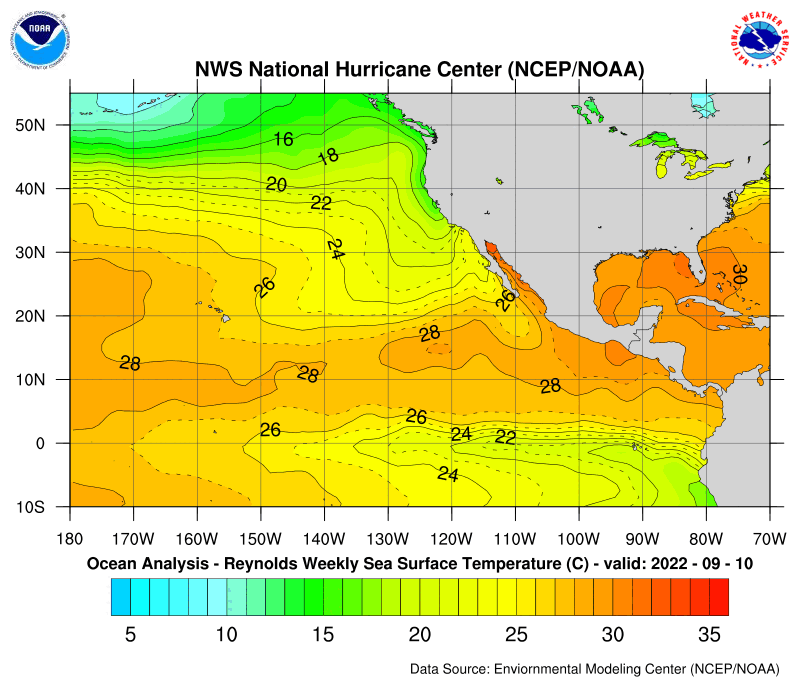
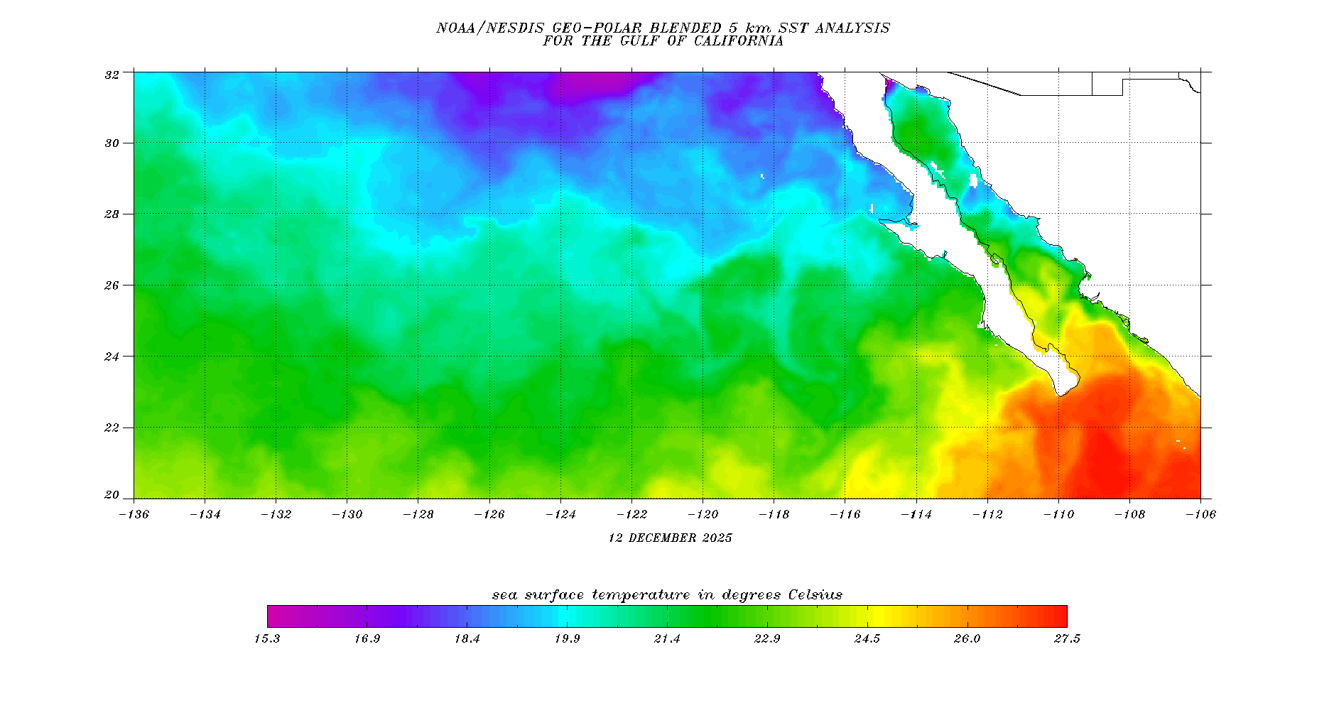
Concurrently, there is zero tropical activity affecting our local waters. The National Hurricane Center confirms that the deep tropics are completely quiet, with no active tropical storms or hurricanes anywhere near our region. Offshore water temperatures display a very sharp, dramatic contrast across the peninsula, featuring extremely warm, tropical sea surface baselines down at the cape confluence that transition rapidly to an incredibly cool, active upwelling zone running right along the Pacific coastline.
Rather than messy local wind waves, the open Pacific waters are currently dominated by an aggressive, highly energized southerly to southwesterly swell train. This long-period swell energy has traveled thousands of miles from the southern hemisphere with wave periods peaking up to an impressive 15 seconds, keeping energy alive down the entire coastline. Meanwhile, the localized heat inside the Gulf of California continues to drive its own distinct regional microclimates, keeping the eastern side of the peninsula completely free of low clouds.
———————–
Regional Marine Reports
Northern Baja Pacific
Offshore waters from the international border south to El Rosario are breaking out into mostly sunny skies after a thin morning marine layer quickly scattered away from the coastal valleys. Winds are holding light and steady out of the west-northwest to northwest between 5 and 16 mph across the region. Coastal sea surface temperatures near Ensenada and San Quintín remain stuck in an incredibly cool range, creating a sharp temperature boundary right at the shoreline. A persistent southwest swell is active across this entire sector, maintaining combined wave heights of 3 to 5 feet, which can occasionally spike up to 6 feet along exposed southwest-facing beaches.
Baja California Sur Pacific
Along the central and southern Pacific coastlines, sky conditions are beautiful and stable as the region enjoys completely clear, sunny skies. Marine environments from Guerrero Negro down to San Juanico are witnessing a very comfortable weather profile, with fresh northwesterly to westerly winds tracking around 8 to 22 mph. Near San Carlos and Todos Santos, conditions feel sunny and a bit warmer, with northwest winds running between 5 and 14 mph. Combined seas throughout these open waters are holding steady, driven by the dominant long-period southerly swell train.
Northern Gulf of California
Conditions across the upper basin near San Felipe and Puertecitos are staying in a very warm range this morning under completely clear, sunny skies. Winds are blowing fresh out of the south-southeast and southeast at 6 to 15 mph, while areas near San Luis Gonzaga see east-northeasterly flow around 8 to 18 mph. This stable gradient is bringing warm air across the coastline, keeping the surface smooth with localized seas running gentle at 2 feet or less across the shallow channels.
Southern Gulf of California
The lower basin, including the waters off Loreto, Mulegé, and La Paz, is basking under perfectly clear skies and a much warmer thermal profile. Winds around Loreto and Mulegé are light to moderate out of the east-northeast at 5 to 12 mph. Near La Paz, winds originate out of the north at 5 to 14 mph. While the daytime ambient air remains a lot hotter than the Pacific coast, marine breezes inside the southern Gulf of California are stable, keeping local seas running gentle at 2 feet or less.
Los Cabos
At the extreme southern tip of the peninsula, open-water conditions remain highly favorable for daytime boaters and beachgoers under mostly sunny skies. Winds are currently blowing out of the south-southwest to west at a gentle 5 to 15 mph. Water temperatures at the cape confluence are holding at very warm levels. While a mild northwest swell is mixing with the primary southern swell train offshore, coastal seas closer to shore remain highly manageable, averaging a smooth 3 to 5 feet.
———————–
Marine Warnings and Hazards
Offshore Swell and Surf Hazards
Real-time offshore maritime data indicates that a persistent, long-period southwesterly swell train will continue to impact the exposed Pacific coastline through the remainder of the weekend. Small craft operators and swimmers should exercise heightened awareness along all southwest-facing beaches and exposed outer reefs.
This highly energized swell is carrying wave periods of up to 15 seconds, which means it packs a hidden punch. While the ambient wind waves remain gentle, these long-period waves are generating heavy breakers of 3 to 5 feet, with local sets pushing up to 6 feet at exposed beach breaks. These conditions are creating hazardous swimming environments and high-risk, invisible rip currents along the entire Pacific side of the peninsula today.
Localized Mountain Pass Wind Venting
Additionally, boaters operating inside the upper Gulf of California near San Felipe should be prepared for sudden wind changes late this afternoon. As the interior desert floor heats up to extreme levels, the intense pressure difference can suck cool air over the mountains, causing quick, gusty wind accelerations through localized passes. While no formal marine warnings are active, small vessels should stay alert for quick surface chop developing near the coast by late afternoon.
———————–
Seawater Surface Temperatures (SSTs)
| Location | Temp | Trend | Notes |
| Bahía Asunción, BCS | 62°F | Warming | Central Baja Pacific upwelling slightly compressing under weakening northwest flow |
| Ba. Los Angeles, BC | 75°F | Cooling | Northern Gulf of California cold water pocket expanding into the channel |
| Ba. San Ignacio, BCS | 71°F | Steady | Central Baja Pacific shallow lagoon tidal exchange maintaining balanced baseline |
| Bahia Gonzaga, BC | 78°F | Cooling | Northern Gulf of California minor surface cooling from overnight drainage winds |
| Cabo San Lucas, BCS | 75°F | Cooling | Southern Baja cape confluence seeing a slight drop under shifting offshore flow |
| Cabo San Quintín, BC | 61°F | Cooling | Northern Baja Pacific persistent cold water cell feeding thick coastal marine layer |
| Ensenada, BC | 70°F | Steady | Northern Baja Pacific stable local current buffering immediate bay temperatures |
| Erendira, BC | 61°F | Steady | Northern Baja Pacific active deep upwelling keeping immediate shoreline chilled |
| Guerrero Negro, BCS | 72°F | Warming | Central Baja Pacific shallow lagoon surface heating outstripping tidal mixing |
| La Paz, BCS | 76°F | Steady | Southern Gulf of California deep basin thermal mass maintaining high baseline |
| Loreto, BCS | 82°F | Warming | Central Gulf of California surface gain locking into stable summer pattern |
| Los Barriles, BCS | 83°F | Steady | Southern Gulf of California intense blue water push maintaining warm profile |
| Mulege, BCS | 85°F | Steady | Central Gulf of California peak solar gain holding high in Concepción basin |
| Playas de Tijuana, BC | 68°F | Steady | Northern Baja Pacific border current holding firm ahead of mid-week high |
| Puertecitos, BC | 82°F | Warming | Northern Gulf of California shallow reach solar absorption heating rapidly |
| Punta Abreojos, BCS | 64°F | Warming | Central Baja Pacific localized southern current shifting warmer air shoreward |
| Rosarito Beach, BC | 61°F | Cooling | Northern Baja Pacific dense marine layer cap limiting daytime solar gain |
| San Carlos, BCS | 69°F | Steady | Southern Baja Pacific shelf water well-buffered by local marine currents |
| San Felipe, BC | 79°F | Steady | Northern Gulf of California high thermal baseline driving intense pressure gradients |
| San Juanico, BCS | 73°F | Steady | Southern Baja Pacific long period swell mixing holding temperature flat |
| Santa Rosalia, BCS | 80°F | Warming | Central Gulf of California mirror-calm state allowing quick surface heating |
| Santa Rosaliíta, BC | 66°F | Warming | Central Baja Pacific northerly breeze weakening, letting surface water warm |
| Todos Santos, BCS | 70°F | Cooling | Southern Baja Pacific local current shift bringing cooler offshore water shoreward |


Tropical Storm Weather Forecast


CURRENT ACTIVE SYSTEM


CURRENT ACTIVE SYSTEM


Offshore Waters Forecast (E Pacific Offshore of Mexico)
Windy 10 Day Forecast
GFS Model
ECMWF Model (European)
Atmospheric Pressure Changes
Sea Surface Temperatures (SST's)